Monthly Archives: August 2016

Great Northwest Passage Trip-Home on the Range

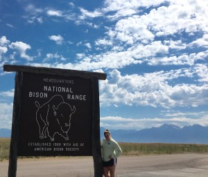
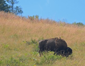
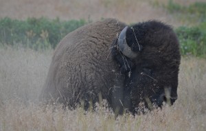
Oh give me a home, where the Buffalo roam, and the deer and the antelope play.” These words to the popular western folk song, Home on the Range, came to life for us on a recent visit to the National Bison Range, in western Montana, where we saw plenty of roaming buffalo (and hanging out, relaxing buffalo) and recreational deer and antelope. All the wildlife (and more) mentioned in the song came out to see us in this 18,800-acre National Wildlife Refuge established by Theodore Roosevelt in 1908. It was the first time that Congress appropriated tax dollars to buy land specifically to conserve wildlife. Currently, the refuge manages between 350-500 Bison. But the Bison share their habitat with many other critters.

20160630_170746727_iOS Bison1

Bison2

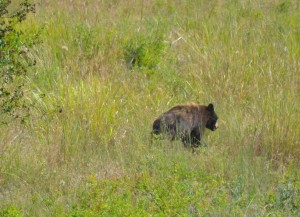
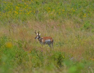
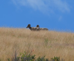
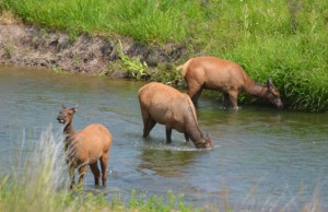
The refuge is a diverse ecosystem of rolling hills and valleys covered with grasslands and forests of Ponderosa Pines and Douglas Firs. Small streams, ponds and the Flathead River can be found in the lowlands. Throughout these lands, Mule deer, White-tailed deer, Elk, Pronghorn, Bighorn Sheep, Black and Grizzly Bear, Mountain Lions, Bobcats, Coyotes, Badgers and over 200 species of birds make this area their home. Many of these animals can be seen from the self-guiding auto tour of Red Sleep Mountain Drive and Prairie Drive. Although it was a bit hot when we visited the refuge in mid-morning, we were excited to see so much wildlife-even more than we observed in some of the larger National Parks we had visited the previous week. In our first 45 minutes, we had good views of Bighorn Sheep, Pronghorn, Mule Deer and Elk, as well as quick looks at a young Black Bear that was searching for berries in and out of a thick, tree-lined stream corridor. But it was the sneaky glimpse of a much smaller mammal on the top of a mountain grassland that got me really excited-a Badger.

BlackBear

                              A young Black Bear searches for berries in the National Bison Range

Pronghorn Bighorns

      Pronghorn Antelope and Bighorn Sheep wander through hundreds of acres of grasslands

This grey, burrowing mammal with a black and white striped face has been on my bucket list for many years. I had missed seeing one in several western states in years past. So, when we crested the steep hill and I saw this shy, feisty carnivore waddling through the tall grass, I hit the brakes as the rental vehicle came to a sliding stop on the rough, gravel road. As I yelled to my daughter to grab my camera, the flat, ghostly mammal disappeared into the tall grass-gone. Technically, I saw a Badger, although it was only a fast look at the hairy rear-end of the animal. It’s still in that bucket! We would like to return to the National Bison Range, where all the wildlife made us feel “Home on the Range!

Elk2 WMeadow

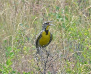
Elk cool off in the Flathead River and a Western Meadowlark sings from a shrub.

Northwest Passage Trip-Days 7, 8 & 9-Going to the Sun

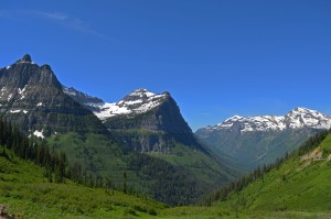
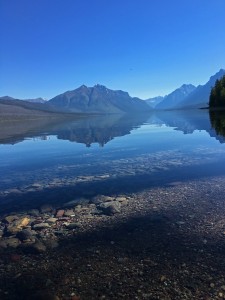
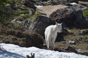
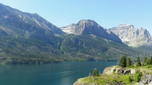
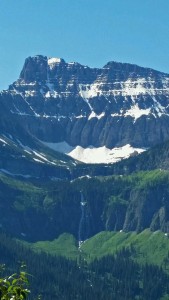
How would you like to take a nice little drive with me? It will only be about 50 miles, but along the way, we’ll see imposing, snow-capped mountains that seem to touch the sky as far as the eye can see. We’ll cross wild-running rivers, and motor past crystal clear, mountain lakes that reflect the surrounding landscapes so clear you would think you’re looking in a mirror. Cautiously, we’ll glide by 800’ rock cliffs that tower above our vehicle on one side, and drop 800’ below our vehicle on the other side! As we continue on our short journey, we’ll traverse the Continental Divide at Logan Pass (6,646’), passing by spectacular views that include cascading waterfalls, and watch Mountain Goats and Bighorn Sheep graze in alpine meadows blooming with brilliant wildflowers. Oh, and glaciers-large, slow-moving masses of ice, snow, rock and sediment that blanket some of the highest peaks and hanging valleys. This is the Going-To-The Sun Road in Glacier National Park, and it’s one of the most beautiful and scenic roadways in America. Want to ride along?

           GLP3 GLP1                         20160628_094925_resized GLP5                               20160629_102005

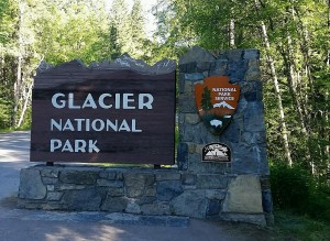
Glacier National Park in northwestern Montana has been nicknamed the “Crown of the Continent.” Part of the Waterton-Glacier International Peace Park that includes Canada and the U.S., Glacier encompasses over a million acres of mountains, rivers, lakes, glaciers, forests and alpine meadows. Within its boundaries you may encounter Grizzly bears, Timber wolves, Mountain lions, Moose, Mountain Goats, Bighorn Sheep, Golden Eagles, Marmots and Cutthroat Trout. It was established as a National Park in 1910, and the Going-to-the Sun road is an engineering marvel. It’s the only road that crosses the entire park and was designed to blend into the mountainside. They did it so well that sometimes you feel like you’re part of the mountainside! As you can read, there’s lots of natural distractions on this twisting, turning road with narrow lanes and lots of traffic. If you don’t concentrate on the road you’re driving on, it can get very ugly. I quickly learned to take advantage of the many turnouts and pull-offs along this amazing road.

               20160628_085324 20160628_105843

But Glacier is not defined by this one 50-mile road. Glacier is much more, and it challenges you to get out of your car and see what lies beyond the road. Its post card-looking scenery summons you to hike a few of its 700 miles of trails, trek to a remote alpine lake or cascading waterfalls, or simply sit and absorb a setting sun. This is Glacier-wild, spectacular, and stunningly beautiful. We accepted the invite to “explore the back country,” except we decided to try a different approach, by sitting on the back of horses.

20160628_144203 20160628_140139GLP6

GLP4 20160629_114023

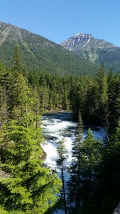
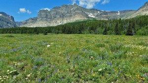
When you venture away from the road in Glacier NP, you’ll find a land full of cascading waterfalls, alpine meadows full of wildflowers and wild rivers and crystal mountain lakes

A Horse Tale

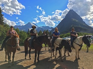
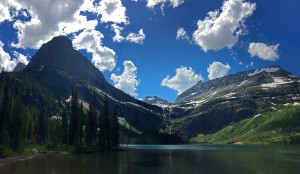
When I booked our horseback riding trip in the Many Glaciers area of the park, they told me it was a leisurely ride for a few miles up an easy trail, ending at a beautiful view of Grinnell Lake and the Grinnell Glacier. They were absolutely true to their word about the panoramic vista of the lake and the glacier-absolutely gorgeous! The leisurely ride for a few miles……well, maybe not so much. Ok, so it’s been 25 years since I’ve been on one of these beasts, and that may have contributed to the “aching discomfort” I experienced in my knees, calves, thighs and of course, my butt. I won’t lie, I was sore all over, for two days after. I know I heard them say on the phone 3 months earlier the ride was about 7 miles, but when we arrived and discussed our route, they stated it was 7 miles one way, about 15 miles round trip. Add the fact that my large, stubborn equine wanted to stop and eat every plant growing along the trail, and the ride quickly turned into a test of stamina between man and beast. By the end of the outing it was Beast 1 – Man 0! Six weeks later, and I still feel a little bow-legged! However, all the pain was worth what we walked out to see at our midway break. It was one of the most dazzling landscapes we had ever seen, and a bonus was a new bird for me, as Tyler spotted an American Dipper walking along the edge of a fast-moving stream. Ahhh Glacier! We’ll be back!

GLP7 GLP2

WCSp20160629_122638-1

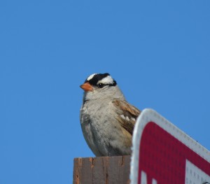
White-crowned Sparrows and Ground squirrels are common species of wildlife in Glacier NP

Northwest Passage Trip-Day 6-Mountain Time

June 26 – 11:30am

After driving east from Olympic National Park for 2.5 hours, and bouncing along a dirt road for the final 25 miles, we were only about 4 miles shy of the trailhead that would be the start of our hike to our destination that day-Mt Rainier. As we drove by 50 other cars, we realized the road was blocked off with a Park Ranger sitting in his truck eating his lunch, and guarding a barricade. Not what we wanted to see. I walked up to ask him about the road ahead, and he paused for a minute after taking a bite of his ham sandwich, wiped the mustard off his mouth, and said, “Nope, the road’s not open yet. Maybe tomorrow or the next day. There’s still a couple feet of snow they’re trying to clear,” and with that, I thanked him and walked back to the car. New plan. We’ll have to drive another 2 hours and enter Mt Rainier National Park from the south.
DSC_0700

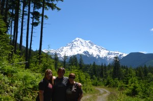
Our first real look at Mt Rainier from the north, Our plans changed when the access road we wanted to use was still not open due to snow.

3:00 pm

Lots of people visiting Mount Rainier today-it’s packed! After several minutes of cruising the crowded Paradise Visitor Center parking lot like a hungry shark looking for its next meal, we finally caught a break when a nice lady from Minnesota “reserved” her space for us as her husband backed their big pick-up truck out. The mountain awaited our arrival.

3:30 pm

We gathered our souvenirs from the gift shop, and headed outside. The Skyline Trail started directly behind the visitor center-lots and lots of people were trying to squeeze on to the 6’ paved trail that led up to our goal 4.5 miles away, called Panaroma Point, elevation 6,800’. At 14,410’ above sea level, Mount Rainier stands as an icon in the Washington landscape. An active volcano, Mount Rainier is the most glaciated peak in the lower 48 states, and is the headwaters for six major rivers.

3:35 pm

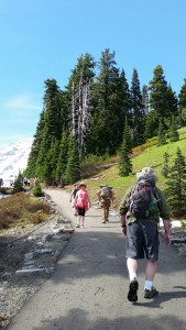
As we begin our hike, I understood why so many people were stopped along the trail only a few hundred yards from the trailhead. It was very steep-about a 20% grade for the first ½ mile. Wow! I know I’m not in great shape, but I was not ready for the immediate rise of this trail. This trail “slaps you in the face” right from the first step. For me, it tested my physical fitness level before my mental fitness level ever knew what was happening! Fifteen minutes into our walk, my calves were burning and I could barely catch my breath. Maybe it was the thin air, or maybe it was just that last handful of Doritos I gobbled down with my turkey sandwich at lunch! But whatever the reason, I knew this “nice little hike” was going to be a real challenge for me. When I was writing this blog, and thinking about photos for it, I asked Darby if she had snapped any pictures showing this steep walk with all the other people. Her response, was “are you kidding, I was too busy trying to breathe!”
             20160626_162623_1470270662125_resized  20160626_170657_resized  20160626_163712_resized

3:55 pm

My enthusiastic pace has slowed considerably. I feel my Bighorn Sheep-like tempo is beginning to resemble a Sloth. Twenty minutes in and my legs feel like lead weights. I did manage to pass several people wearing flip-flops and four baby strollers. Theresa is just ahead of me, but Tyler and Darby are at least ¼-mile out in front.
                   20160626_164900-1_resized IMG_4789

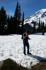
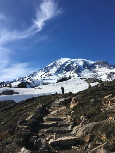
Tyler checks the map in the 1st snowfield to see if we’re even close to the hidden trail, then continues out in front.

4:15 pm

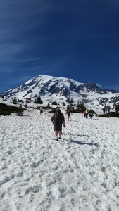
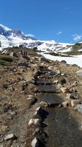
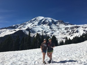
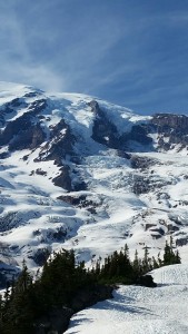
In full view now, Mount Rainier is getting larger and more majestic with each step. After what seemed like 57 stops to catch my breath, and nearly drinking all my water in less than a mile, the marked, paved trail is gone. We were now hiking through a snow field. It’s pretty cool to be hiking through snow, in shorts and t-shirts in June. Most of the crowd decided to turn back when the pavement ended, or they simply couldn’t breathe, whatever the reason, only a few dozen adventurers continue on now.
20160626_235706289_iOS               20160626_173402_resized

4:45 pm

The soft, melting snow makes for some tough walking. It’s similar to trudging through deep, dry sand at the beach, except colder. There’s no trail to follow now, so, like Caribou migrating across the tundra, we follow each other, and the footprints of others who have gone before us. We have to move to the side as several climbers who have successfully reached the summit a few hours before, are now skiing their way back down the mountain as far as the snow stretches.

5:20 pm

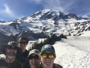
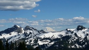
We’ve managed to reach a small viewing area called Avalanche Point. This is as far as we can realistically go without proper snow climbing gear, such as crampons and trekking poles. Panaroma Point is still high above us-about another 1.5 miles hiking through a steep, snow-covered trail. Nope, this is as close to Mt Rainier as we’re going to get today. But, it’s still an awesome vista. As we turn around, looking back down the mountain, we can clearly see Mt St Helens and Mt Hood in the distance.
20160627_003555456_iOS 20160626_171149_resized

                                    A selfie at Avalanche Point, and a look at Mt St Helens in the distance.

5:50 pm

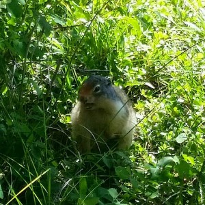
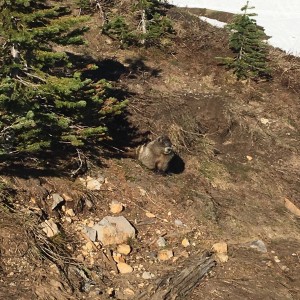
We begin our descent back down the mountain, deviating from our route up. We think we found what is supposed to be the marked trail, as we dance our way down through the soft, melting snow. It’s actually kinda fun as we slip, slide and take a tumble or two. As I try to show-off my slick mountaineering skills, I suddenly lose my footing and come crashing down in a heap. A little embarrassed and with 2 pounds of snow now down my pants, I pick myself up and continue walking, trying to act like nothing happened! I don’t think anyone saw me, except for the six teenagers laughing and all pointing their cell phones at me. We stop for a brief rest and hear whistles echoing from the bare patches of alpine meadow-Marmots. These high elevation rodents communicate to each other through a series of whistles, like someone whistling to their dog.
FullSizeRender (1)

6:30 pm

We finally exit the snow fields and make our way back to the paved trail, eventually reaching the visitor center. It’s been a great hike through the snow to the base of one the largest mountains in the U.S. My knees are aching, I’m hungry and thirsty, but will always remember this “nice little walk” we took one day in late June to see Mt Rainier!